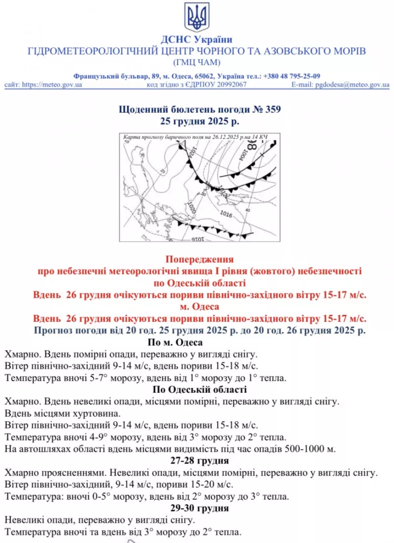

Odesa and Odesa region have declared Level I danger due to expected deterioration of weather conditions. According to the Hydrometeorological Center of the Black and Azov Seas, the city will be covered by a powerful Scandinavian anticyclone "Nella", which will bring sharp cooling and dangerous weather phenomena.
What Odesa residents can expect in the coming days
On December 26, meteorologists forecast particularly difficult weather conditions. At night, the temperature will drop to 5-7°C below zero, during the day it will fluctuate from 1°C below zero to 1°C above zero. Moderate precipitation mainly in the form of snow is expected during the day, with possible blizzards in some places.
The greatest threat will be northwest wind at 9-14 m/s with gusts up to 15-18 m/s. Significant waves are forecast at sea, creating additional risks for residents of coastal areas.
Danger on roads and in the city
On the region's highways, visibility during precipitation will decrease to critical 500-1000 meters. Fog is expected during night and morning hours, which will further complicate vehicle movement.
City authorities warn residents about the need to limit movement around the city in bad weather and be careful under trees due to possible falling branches and cables from gusty wind.
Special danger on the coast
Due to the storm at sea, mine danger significantly increases. Strong waves can tear sea mines from anchors and wash them ashore. Authorities have categorically banned staying in the beach area and reminded: if suspicious objects are found on the shore, you should immediately call 102.
Service readiness
Odesa's municipal services assure full readiness for deteriorating weather conditions. Drivers are recommended not to leave cars under trees, power lines and on storm drain grates.
Seawater temperature will be 6-7°C, which combined with strong wind creates additional risks for any activities near water.