
Since the start of Russia's full-scale invasion of Ukraine, interactive online maps have become an indispensable safety tool for Ukrainians. They allow instant tracking of air danger zones and missile strike threats in real-time.
How Air Raid Maps Work
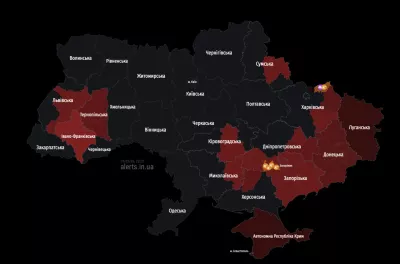
Today, several official and independent online services provide current information about the air situation in the country:
- Map updates every 15-25 seconds
- Uses different color-coded threat indicators:
- Red - air raid alert
- Green - no alert
- Gray - no information
Additional Service Features
Map developers have created convenient smartphone apps for Android, iOS, and Harmony OS, which allow setting up notifications for selected regions. Users can view the start time and duration of air raids.
Threat Types on Maps
Modern online maps display not only air raid alerts, but also other potential dangers:
- Yellow color - areas of increased attention
- Green - chemical hazard zone
- Pink shades - alert in a city, community, district, or region
An air raid signal is an official "Attention to All!" warning, which sounds like a siren wail or industrial object horns.